Summit Markers
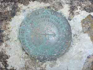
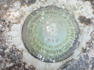
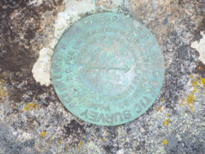
On the summit of St. Regis Mountain near the fire tower there are three markers imbedded in the rock. These markers were placed by the U.S. Coast & Geodetic Survey (USCGS) in 1942. The marker with the triangle stamped in the center is often referred to as a bench mark, but in this case it is actually a Triangulation Station; the other markers are Reference Marks that were placed to help locate the station and to reestablish it if necessary.
The 1942 placement of these markers is likely significant as World War Two was in progress and there was an effort to create a rigid framework for accurate mapping which would strengthen the defense of the Nation in case there was a need for military activities.
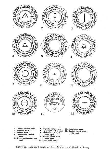
The chart here illustrates the various types of markers used by the USCGS. For more information on these go to https://www.ngs.noaa.gov/PUBS_LIB/TRNOS88NGS19.pdf
The USCGS now falls under the auspices of the National Oceanic and Atmospheric Administration (NOAA).